
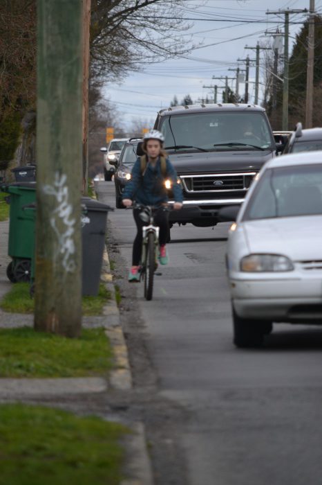
As I was driving home from school one day, I hurriedly pulled out of rush-hour traffic onto the shoulder of the Trans-Canada Highway to try to help a stalled motorist, who had been backing up traffic for blocks. As a regularly harried, sometimes-self-absorbed commuter—intent on getting to Sooke—I saw a cyclist approaching but wasn’t completely aware that their path had shifted because of the construction.
Cyclists were being forced to divert from a paved surface—strewn with gravel—onto packed road base, down onto the shoulder of the highway, and then back up a slope of more packed road base. I saw the cyclist—even though their dark blue and black jacket blended into the dreary day, their helmet was brightly coloured—and stopped, but I didn’t realize how close I was to the re-entry onto the Galloping Goose trail, and the cyclist had been looking down.
As I stared at the startled, angry cyclist—dude, I’m sorry—I had no idea how to handle the situation. As a commuter, I try to be aware of cyclists. But I was not expecting one to be forced to commute on the shoulder of the Trans-Canada Highway.
Roadwork construction is disrupting vehicular flow. The Galloping Goose construction is disrupting active transportation flow. Tempers everywhere out there are short. Throw in drivers’ and cyclists’ ignorance of road rules, and there’s a high possibility of potentially dangerous situations.
With so many construction zones around Camosun lately, and the ongoing problem of unsafe cycling areas around the school (hello, Shelbourne corridor), it’s time to ask the question: how safe is it for Camosun students who cycle to school?
THE DANGER ZONE
As it turns out, one of the routes that Google Maps suggests for cycling between Camosun’s Lansdowne and Interurban campuses brings people close to the area of my incident. The internet is a useful tool for student cyclists: bikemaps.org, for example, is a site that maps out cyclist hazards, crashes, near misses, and bike thefts. I have to wonder what bikemaps.org would look like with more recent information; that commute between campuses has 84 recorded accidents, hazards, and near misses. The second route, going up Richmond Road, has spikes of accidents on Cedar Hill Cross Road—12—and McKenzie—15—for a total of 27 recorded incidents on the route. And Shelbourne Street is just a mess of near misses and collisions.
Since bikemaps.org is such a useful tool—when it launched, it was the only way to record near misses—it’s no surprise that Saanich senior transportation technologist Troy McKay says that the district decided to work with the website as part of its 30-year Active Transportation Plan.
“It’s a UVic-based organization,” says McKay of the website, “and they collect ICBC-, police-, and user-reported accident data and near-miss data for cyclists. They gave us a map, which shows some of the 20 worst locations in Saanich. We got that about a year ago, and we’re already in the process of fixing three of those worst 20 right now. And the Lansdowne corridor was one of those that was on the map. The rest of them will be worked into priorities in future years as we work down the list.”
One particularly sketchy road for students cycling to Camosun is Shelbourne; there are 15 recorded incidents with cyclists on Shelbourne between Hillside Avenue and Cedar Hill Cross Road alone. Camosun first-year Practical Nursing student Kasey Chou says that Shelbourne is a really scary place to be during rush hour. Some drivers are aware of cyclists, but some aren’t.
“There’s a lot of traffic there,” says Chou. “Like, quite a lot. And, especially during rush hour, there are a lot of bigger trucks as well, and they’re not always so kind to cyclists. I’ve been honked at. I mean, I keep to my right side of the road, but there are still people who will just barely scrape past me, and that’s scary.”
Meagan Hogg, a graduate of Camosun’s Hotel and Restaurant Management program, says that drivers could do more shoulder-checking instead of relying on their mirrors.
“Look before you put yourself into another lane if you’re driving a vehicle, because if I make a mistake on a bike, I kill myself,” says Hogg. “Someone driving a vehicle is gonna be upset. But when you’re driving a vehicle, it’s not your life that’s on the line, it’s the lives of pedestrians and cyclists around you. So double check.”
CYCLISTS BEWARE
Bikemaps.org has 21 recorded incidents happening between Tillicum Road and McKenzie Avenue—the area where I first really understood the danger that cyclists had been placed in by a construction zone during my above-documented incident.
On a typical ride to school, Camosun students pass through a lot of hazards; Hogg says that some of these hazards include construction sites and other users of the road.
“Some of the construction sites could use better signage for their abrupt lane ends,” she says. “That would be great, especially on Pandora right now: it’s one lane, two lanes to go through an intersection, and then, on the other side of the intersection, it’s one lane again. And there are a lot of potholes right now. It’s not too bad if you know where they are.”
If you’re biking downtown, you might have to add needles to the list of things to watch out for. Hogg says that there are many hazards to biking around the city, including potholes and broken glass.
“[Needles are] an unfortunate reality of going down Pandora [Avenue],” she says. “It’s usually pretty good, but, occasionally, there are needles in the road, which is kind of gross. I just let the city know, and they’re usually pretty good about getting them.”
Closer to Camosun, sections of the road and sidewalk in front of the Lansdowne campus have recently been pulled up and turned into road base paths. Unpacked road base is composed of grey stones that sink easily under weight. Hogg says that a hazard around construction sites is this gravel, as well as debris on the road, steel plates, and—unexpectedly, for Victoria—snow.
“Biking from straight, nice pavement into gravel, similar to a vehicle, you just lose control really easily,” she says. “Those big metal sheets that they put over top are super great for covering the big construction holes in the middle of the lanes, but super slippery in the wet, and, if it’s close to freezing at all, sketchy. This year there was a lot of snow.”
Greater Victoria Cycling Coalition president Edward Pullman says that approximately half of the recorded cycling-related accidents in Victoria take place in intersections.
“We say something’s an ‘accident,’ but 90 percent of the time it’s preventable,” says Pullman. “So is it really an accident? If a light pole falls on you, that’s pretty much accidental. Intersections are a huge challenge and a huge concern.”
Pullman says that one of the things that the City of Victoria is currently spending time considering is how to protect cyclists in intersections.
“You’ve always got the concern of vehicles that are turning off,” he says. “So, how you can restrict turns for vehicles, such that they reduce the risk of a cyclist being hit by an errant vehicle turning into a cyclist? Intersections are a huge issue, and they’re very often an issue that gets neglected. They’re like, ‘We’ll put a bike lane in, but then when we get to an intersection, we’ll just expect that they’ll be fine.’”
If a cyclist decides to stay off the roads and take the Galloping Goose Trail to Interurban, the road conditions might not be any better. Pullman says the quality of roads—and trails—is an issue.
“You’ve got the Colquitz River Trail, which might be a nice route to take as a cyclist,” he says. “But given its rocky nature—it’s not paved—that certainly makes it a less desirable route to take.”
Add in confusion over the new bike lane/sidewalk convergence on the northwest corner of Lansdowne and Richmond, where no one really knows where to stand or cycle, and it’s easy to see how these are trying times for Camosun cyclists.
THE CAR/CYCLIST DIVIDE
As a driver, one of my biggest fears when I was learning to drive was the cyclist. I’d heard much about this unpredictable commuter—the slow-moving target that would be difficult to see due to inappropriate clothing choices, such as dark colours. No one wants to be responsible for injuring another person.
Pullman says the government’s Motor Vehicle Act—last updated in 1997—remains unclear on when a cyclist can take a lane. Pullman sent me a video of an incident at UVic—asking me not to contact the cyclist—where a cyclist was forced off the road by a vehicle.
“He’s travelling along Finnerty Road, between the bus stop and the Student Union Building, and a car essentially comes up behind him and forces him out of the way,” says Pullman, “despite the fact that there’s very clearly bicycle markings on the road indicating a cyclist can take the lane. He contacted Saanich police, and Saanich police essentially told him, ‘You’re in the wrong for not allowing enough space to pass,’ because the Motor Vehicle Act technically says you’re allowed to pass, essentially, when it’s safe to do so, but it doesn’t clarify exactly when. So, really, in the laws we need a minimum passing distance. Ontario recently beefed up its pedestrian cycling safety laws, and one of the things they said there was that there must be one metre to pass, and you can clearly see that there isn’t one metre to pass in that video.”
Pullman says that the challenge is that we have a legal system that is not really geared toward cyclists, in terms of making cyclists feel safe on the roads and also recognizing what Pullman says is the cyclist’s vulnerable status as a road user.
“And we don’t feel that that’s currently reflected in both infrastructure and the law,” he says. “I’m not going to tell you what the law is, because the law is the law. We happen to not agree with a lot of the laws out there, because they treat cyclists the same as they treat motor vehicles and don’t really recognize the fact that cyclists are vulnerable road users. The whole concept of ‘same road, same rules’ is inherently flawed, without question. The road is the same, yes, but a cyclist’s ability to afflict harm is extremely limited. Cars can kill. Cars can kill and do inflict extreme amounts of property damage when used improperly. Cycling, not so much.”
Part of the new bike path construction on Lansdowne takes cyclists off the road and onto the sidewalk. Camosun College Student Society sustainability director Shauna Nedelec says it looks good out there so far.
“Instead of being directly next to the curb, kind of by Lansdowne Middle School, they have a new patch where it’s kind of elevated off,” says Nedelec. “So, basically, the bike path is on the sidewalk, which I think is good because it can get busy. I think it’s actually a good construction that they did there. I’ve seen that in other cities, where instead of it being directly next to cars, you have a bike path that’s next to the pedestrians.”
Since students tend to mill on the cyclist-designated stretch of sidewalk, cyclist/pedestrian collisions might become more frequent, and Hogg says it’s unsafe to have cyclists—who can travel at vehicular speeds—on the sidewalk. Hogg says her top recorded speed is around 55 kilometres per hour, but she can regularly hit speeds of 35 to 38 during her commute.
“It’s gonna basically turn my commute into walking speed if I’m stuck behind people taking the scenic route,” says Hogg. “Which is great—I don’t want to deride them from having their own cycling experience—but I also anticipate there being a lot of aggression directed toward cyclists that are still in the traffic, which will be, unfortunately, an interesting thing to look at. It’s challenging.”
McKay says that the Lansdowne project is a good example of what the district of Saanich can do to help give cyclists their own space.
“There are a bunch of features built into that, with tighter radiuses of the intersections, to shorten crossing distances, [and] specific crosswalks that are assigned for cyclists and pedestrians, to give cyclists some extra space to ride across those intersections,” says McKay. “And then along the college front itself, there’s a two-way multi-use trail that’s designed to take cyclists right out of vehicle traffic and give them their own space where they can ride. There are a lot of people trying to access into the college, so that’s why it was put on that side.”
SAANICH HAS A PLAN
Camosun manager of transportation and parking Jonathan Siqueira says he hasn’t received any complaints from cyclists finding the construction around Lansdowne overly treacherous.
“I know with the weather recently, I imagine that there is a fair amount of debris on the roads wherever you go,” says Siqueira. “And I think that, at Interurban especially, it’s a bit of an issue for people cycling there, because I guess that tends to get a little bit dirtier than around here, although that may be far-fetched, considering the weather.”
Saanich has said that some current cycling-related projects include Lansdowne Road from Shelbourne to Richmond; the Wilkinson Bridge/Colquitz River Trail; the Galloping Goose–Carey Road connection; and McKenzie Avenue from Cedar Hill to Shelbourne. McKay says that Saanich wants to build a community that cyclists can feel safe in.
“Saanich’s official community plan has some guidance that we want to build a walkable, bikeable community where walking and riding bikes are an alternative and people feel safe doing that,” says McKay. “So that’s kind of the overarching guidance. And then, what we’re looking at is what does the network look like, where are the routes, and what kind of infrastructure do we have on those routes? And then what is the priority area for building those? We only have so much money—and 700 kilometres of road to work on—and infrastructure is quite expensive, so [we need] to be strategic about where we spend that money.”
McKay stresses that this is a community-based plan, with lots of community input in regard to where the routes are and what people’s priorities are.
“We’ve just finished the first phase, which is asking people lots of questions about what do they see is the future of walking and biking in Saanich, and then we’ll start to develop a draft network, and that will be out next fall to say, ‘This is what we’ve come up with; what do you think?’”
And it’s not a moment too soon: bikemaps.org has high-accident areas reported around Camosun’s Lansdowne campus, UVic, and one of the Google-Map-suggested routes to Interurban. It’s obvious that students seeking more active forms of transportation aren’t always protected.
CHANGE IS POSSIBLE
Some Interurban cyclists, like Elsie Gilchrist—a second-year Psychology student—say that it really isn’t that bad of a commute. But she does point toward Richmond Road, by Lansdowne, and its lack of a bike lane.
“It’s nice that the construction’s over, at least where it affected me,” says Gilchrist. “But one thing I will say is, when you go to the front of the school over there [Richmond Road] and you’re turning right, there’s the sidewalk, and then there’s the actual road—there’s no bike lane right there. You have to go around the sidewalk, into the lane of traffic, and then over. So I think that it feels like a little bit of a blind spot, in terms of biking, because you know that there’s a bike lane, but then there’s that weird area, where there’s nothing right there. Other than that, though, it’s good. I like the improvements they made.”
Some cyclists are insisting that the laws need to change. Pullman says the government doesn’t seem to have much of an interest in improving things for cyclists even though they have no problems increasing speed limits, which does not make for safer roads.
“That may change in the future,” says Pullman. “These issues have been out there for a long time, and we haven’t seen really much in the way of improvements. Certainly, there’s a lot of discussion about it. There are a lot of organizations that support changing the law, but, again, it’s been many years.”